


Dickinson County, Kansas
About
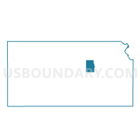
Outline

Summary
| Unique Area Identifier | 120125 |
| Name | Dickinson County |
| State | Kansas |
| Area (square miles) | 851.95 |
| Land Area (square miles) | 847.07 |
| Water Area (square miles) | 4.88 |
| % of Land Area | 99.43 |
| % of Water Area | 0.57 |
| Latitude of the Internal Point | 38.86773530 |
| Longtitude of the Internal Point | -97.15794340 |
| Total Population | 19,754 |
| Total Housing Units | 8,972 |
| Total Households | 8,073 |
| Median Age | 41.4 |
Maps

Graphs
Select a template below for downloading or customizing gragh for Dickinson County, Kansas


Neighbors
Neighoring County (by Name) Neighboring County on the Map
- Clay County, KS
- Geary County, KS
- Marion County, KS
- McPherson County, KS
- Morris County, KS
- Ottawa County, KS
- Saline County, KS
County Subdivision in Dickinson County (by Name) Neighboring County Subdivision on the Map
- Abilene city, Dickinson County, KS
- Banner township, Dickinson County, KS
- Buckeye township, Dickinson County, KS
- Center township, Dickinson County, KS
- Cheever township, Dickinson County, KS
- Flora township, Dickinson County, KS
- Fragrant Hill township, Dickinson County, KS
- Garfield township, Dickinson County, KS
- Grant township, Dickinson County, KS
- Hayes township, Dickinson County, KS
- Herington city, Dickinson County, KS
- Holland township, Dickinson County, KS
- Hope township, Dickinson County, KS
- Jefferson township, Dickinson County, KS
- Liberty township, Dickinson County, KS
- Lincoln township, Dickinson County, KS
- Logan township, Dickinson County, KS
- Lyon township, Dickinson County, KS
- Newbern township, Dickinson County, KS
- Noble township, Dickinson County, KS
- Ridge township, Dickinson County, KS
- Rinehart township, Dickinson County, KS
- Sherman township, Dickinson County, KS
- Union township, Dickinson County, KS
- Wheatland township, Dickinson County, KS
- Willowdale township, Dickinson County, KS
Top 10 Neighboring Place (by Population) Neighboring Place on the Map
- Abilene city, KS (6,844)
- Herington city, KS (2,526)
- Chapman city, KS (1,393)
- Solomon city, KS (1,095)
- Enterprise city, KS (855)
- Hope city, KS (368)
- Woodbine city, KS (170)
- Detroit CDP, KS (114)
- Talmage CDP, KS (99)
- Manchester city, KS (95)
Top 10 Neighboring Unified School District (by Population) Neighboring Unified School District on the Map
- Abilene Unified School District 435, KS (8,821)
- Clay Center Unified School District 379, KS (8,219)
- Smoky Valley Unified School District 400, KS (6,414)
- Chapman Unified School District 473, KS (6,205)
- Durham-Hillsboro-Lehigh Unified School District 410, KS (4,376)
- Southeast of Saline Unified School District 306, KS (3,078)
- Herington Unified School District 487, KS (3,012)
- Rural Vista Unified School District 481, KS (2,239)
- Solomon Unified School District 393, KS (2,039)
- Centre Unified School District 397, KS (1,554)
Top 10 Neighboring State Legislative District Lower Chamber (by Population) Neighboring State Legislative District Lower Chamber on the Map
- State House District 64, KS (32,032)
- State House District 65, KS (22,589)
- State House District 108, KS (21,374)
- State House District 73, KS (20,713)
- State House District 68, KS (20,392)
- State House District 70, KS (20,195)
- State House District 107, KS (19,899)
Top 10 Neighboring State Legislative District Upper Chamber (by Population) Neighboring State Legislative District Upper Chamber on the Map
- State Senate District 22, KS (95,140)
- State Senate District 24, KS (71,161)
- State Senate District 35, KS (66,006)
- State Senate District 17, KS (62,307)
- State Senate District 21, KS (61,803)
Top 10 Neighboring 111th Congressional District (by Population) Neighboring 111th Congressional District on the Map
Top 10 Census Tract in Dickinson County (by Population) Neighboring Census Tract on the Map
- Census Tract 844, Dickinson County, KS (5,141)
- Census Tract 841, Dickinson County, KS (4,058)
- Census Tract 845, Dickinson County, KS (3,104)
- Census Tract 846, Dickinson County, KS (2,568)
- Census Tract 842, Dickinson County, KS (2,525)
- Census Tract 843, Dickinson County, KS (2,358)
Top 10 Neighboring 5-Digit ZIP Code Tabulation Area (by Population) Neighboring 5-Digit ZIP Code Tabulation Area on the Map
- 66441, KS (26,746)
- 67410, KS (10,141)
- 67432, KS (6,019)
- 67449, KS (3,351)
- 67431, KS (2,471)
- 67480, KS (1,805)
- 67487, KS (1,422)
- 67448, KS (1,374)
- 66872, KS (1,134)
- 67441, KS (1,115)
Data
Demographic, Population, Households, and Housing Units
** Data sources from census 2010 **
Show Data on Map
Download Full List as CSV
Download Quick Sheet as CSV
| Subject | This Area | Kansas | National |
|---|---|---|---|
| POPULATION | |||
| Total Population Map | 19,754 | 2,853,118 | 308,745,538 |
| POPULATION, HISPANIC OR LATINO ORIGIN | |||
| Not Hispanic or Latino Map | 18,985 | 2,553,076 | 258,267,944 |
| Hispanic or Latino Map | 769 | 300,042 | 50,477,594 |
| POPULATION, RACE | |||
| White alone Map | 18,780 | 2,391,044 | 223,553,265 |
| Black or African American alone Map | 153 | 167,864 | 38,929,319 |
| American Indian and Alaska Native alone Map | 99 | 28,150 | 2,932,248 |
| Asian alone Map | 61 | 67,762 | 14,674,252 |
| Native Hawaiian and Other Pacific Islander alone Map | 11 | 2,238 | 540,013 |
| Some Other Race alone Map | 206 | 110,127 | 19,107,368 |
| Two or More Races Map | 444 | 85,933 | 9,009,073 |
| POPULATION, SEX | |||
| Male Map | 9,732 | 1,415,408 | 151,781,326 |
| Female Map | 10,022 | 1,437,710 | 156,964,212 |
| POPULATION, AGE (18 YEARS) | |||
| 18 years and over Map | 14,859 | 2,126,179 | 234,564,071 |
| Under 18 years | 4,895 | 726,939 | 74,181,467 |
| POPULATION, AGE | |||
| Under 5 years | 1,286 | 205,492 | 20,201,362 |
| 5 to 9 years | 1,371 | 202,447 | 20,348,657 |
| 10 to 14 years | 1,346 | 198,884 | 20,677,194 |
| 15 to 17 years | 892 | 120,116 | 12,954,254 |
| 18 and 19 years | 446 | 83,705 | 9,086,089 |
| 20 years | 172 | 42,758 | 4,519,129 |
| 21 years | 176 | 40,931 | 4,354,294 |
| 22 to 24 years | 561 | 120,765 | 12,712,576 |
| 25 to 29 years | 1,054 | 197,783 | 21,101,849 |
| 30 to 34 years | 1,099 | 179,937 | 19,962,099 |
| 35 to 39 years | 1,131 | 172,388 | 20,179,642 |
| 40 to 44 years | 1,175 | 174,285 | 20,890,964 |
| 45 to 49 years | 1,509 | 201,830 | 22,708,591 |
| 50 to 54 years | 1,553 | 204,434 | 22,298,125 |
| 55 to 59 years | 1,344 | 182,512 | 19,664,805 |
| 60 and 61 years | 460 | 63,661 | 7,113,727 |
| 62 to 64 years | 613 | 85,074 | 9,704,197 |
| 65 and 66 years | 379 | 46,574 | 5,319,902 |
| 67 to 69 years | 517 | 61,181 | 7,115,361 |
| 70 to 74 years | 786 | 82,634 | 9,278,166 |
| 75 to 79 years | 647 | 69,466 | 7,317,795 |
| 80 to 84 years | 603 | 56,943 | 5,743,327 |
| 85 years and over | 634 | 59,318 | 5,493,433 |
| MEDIAN AGE BY SEX | |||
| Both sexes Map | 41.40 | 36.00 | 37.20 |
| Male Map | 40.20 | 34.70 | 35.80 |
| Female Map | 42.70 | 37.40 | 38.50 |
| HOUSEHOLDS | |||
| Total Households Map | 8,073 | 1,112,096 | 116,716,292 |
| HOUSEHOLDS, HOUSEHOLD TYPE | |||
| Family households: Map | 5,459 | 734,103 | 77,538,296 |
| Husband-wife family Map | 4,382 | 568,309 | 56,510,377 |
| Other family: Map | 1,077 | 165,794 | 21,027,919 |
| Male householder, no wife present Map | 347 | 50,014 | 5,777,570 |
| Female householder, no husband present Map | 730 | 115,780 | 15,250,349 |
| Nonfamily households: Map | 2,614 | 377,993 | 39,177,996 |
| Householder living alone Map | 2,244 | 309,338 | 31,204,909 |
| Householder not living alone Map | 370 | 68,655 | 7,973,087 |
| HOUSEHOLDS, HISPANIC OR LATINO ORIGIN OF HOUSEHOLDER | |||
| Not Hispanic or Latino householder: Map | 7,868 | 1,034,342 | 103,254,926 |
| Hispanic or Latino householder: Map | 205 | 77,754 | 13,461,366 |
| HOUSEHOLDS, RACE OF HOUSEHOLDER | |||
| Householder who is White alone | 7,817 | 968,996 | 89,754,352 |
| Householder who is Black or African American alone | 46 | 62,558 | 14,129,983 |
| Householder who is American Indian and Alaska Native alone | 40 | 9,675 | 939,707 |
| Householder who is Asian alone | 18 | 20,990 | 4,632,164 |
| Householder who is Native Hawaiian and Other Pacific Islander alone | 2 | 684 | 143,932 |
| Householder who is Some Other Race alone | 56 | 30,076 | 4,916,427 |
| Householder who is Two or More Races | 94 | 19,117 | 2,199,727 |
| HOUSEHOLDS, HOUSEHOLD TYPE BY HOUSEHOLD SIZE | |||
| Family households: Map | 5,459 | 734,103 | 77,538,296 |
| 2-person household Map | 2,754 | 328,461 | 31,882,616 |
| 3-person household Map | 1,096 | 156,935 | 17,765,829 |
| 4-person household Map | 881 | 137,076 | 15,214,075 |
| 5-person household Map | 468 | 68,988 | 7,411,997 |
| 6-person household Map | 169 | 26,923 | 3,026,278 |
| 7-or-more-person household Map | 91 | 15,720 | 2,237,501 |
| Nonfamily households: Map | 2,614 | 377,993 | 39,177,996 |
| 1-person household Map | 2,244 | 309,338 | 31,204,909 |
| 2-person household Map | 315 | 53,935 | 6,360,012 |
| 3-person household Map | 32 | 9,186 | 992,156 |
| 4-person household Map | 13 | 3,829 | 411,171 |
| 5-person household Map | 9 | 1,105 | 126,634 |
| 6-person household Map | 1 | 366 | 48,421 |
| 7-or-more-person household Map | 0 | 234 | 34,693 |
| HOUSING UNITS | |||
| Total Housing Units Map | 8,972 | 1,233,215 | 131,704,730 |
| HOUSING UNITS, OCCUPANCY STATUS | |||
| Occupied Map | 8,073 | 1,112,096 | 116,716,292 |
| Vacant Map | 899 | 121,119 | 14,988,438 |
| HOUSING UNITS, OCCUPIED, TENURE | |||
| Owned with a mortgage or a loan Map | 3,500 | 502,825 | 52,979,430 |
| Owned free and clear Map | 2,348 | 250,707 | 23,006,644 |
| Renter occupied Map | 2,225 | 358,564 | 40,730,218 |
| HOUSING UNITS, VACANT, VACANCY STATUS | |||
| For rent Map | 187 | 40,445 | 4,137,567 |
| Rented, not occupied Map | 13 | 1,962 | 206,825 |
| For sale only Map | 141 | 16,286 | 1,896,796 |
| Sold, not occupied Map | 45 | 5,267 | 421,032 |
| For seasonal, recreational, or occasional use Map | 74 | 12,763 | 4,649,298 |
| For migrant workers Map | 0 | 129 | 24,161 |
| Other vacant Map | 439 | 44,267 | 3,652,759 |
| HOUSING UNITS, OCCUPIED, AVERAGE HOUSEHOLD SIZE BY TENURE | |||
| Total: Map | 2.41 | 2.49 | 2.58 |
| Owner occupied Map | 2.50 | 2.60 | 2.65 |
| Renter occupied Map | 2.18 | 2.27 | 2.44 |
| HOUSING UNITS, OCCUPIED, TENURE BY RACE OF HOUSEHOLDER | |||
| Owner occupied: Map | 5,848 | 753,532 | 75,986,074 |
| Householder who is White alone Map | 5,714 | 687,183 | 63,446,275 |
| Householder who is Black or African American alone Map | 20 | 24,574 | 6,261,464 |
| Householder who is American Indian and Alaska Native alone Map | 26 | 5,172 | 509,588 |
| Householder who is Asian alone Map | 8 | 11,985 | 2,688,861 |
| Householder who is Native Hawaiian and Other Pacific Islander alone Map | 2 | 262 | 61,911 |
| Householder who is Some Other Race alone Map | 32 | 15,020 | 1,975,817 |
| Householder who is Two or More Races Map | 46 | 9,336 | 1,042,158 |
| Renter occupied: Map | 2,225 | 358,564 | 40,730,218 |
| Householder who is White alone Map | 2,103 | 281,813 | 26,308,077 |
| Householder who is Black or African American alone Map | 26 | 37,984 | 7,868,519 |
| Householder who is American Indian and Alaska Native alone Map | 14 | 4,503 | 430,119 |
| Householder who is Asian alone Map | 10 | 9,005 | 1,943,303 |
| Householder who is Native Hawaiian and Other Pacific Islander alone Map | 0 | 422 | 82,021 |
| Householder who is Some Other Race alone Map | 24 | 15,056 | 2,940,610 |
| Householder who is Two or More Races Map | 48 | 9,781 | 1,157,569 |
| HOUSING UNITS, OCCUPIED, TENURE BY HISPANIC OR LATINO ORIGIN OF HOUSEHOLDER | |||
| Owner occupied: Map | 5,848 | 753,532 | 75,986,074 |
| Not Hispanic or Latino householder Map | 5,729 | 712,297 | 69,617,625 |
| Hispanic or Latino householder Map | 119 | 41,235 | 6,368,449 |
| Renter occupied: Map | 2,225 | 358,564 | 40,730,218 |
| Not Hispanic or Latino householder Map | 2,139 | 322,045 | 33,637,301 |
| Hispanic or Latino householder Map | 86 | 36,519 | 7,092,917 |
| HOUSING UNITS, OCCUPIED, TENURE BY HOUSEHOLD SIZE | |||
| Owner occupied: Map | 5,848 | 753,532 | 75,986,074 |
| 1-person household Map | 1,247 | 162,494 | 16,453,569 |
| 2-person household Map | 2,519 | 290,679 | 27,618,605 |
| 3-person household Map | 852 | 115,203 | 12,517,563 |
| 4-person household Map | 693 | 104,478 | 10,998,793 |
| 5-person household Map | 339 | 50,611 | 5,057,765 |
| 6-person household Map | 132 | 19,205 | 1,965,796 |
| 7-or-more-person household Map | 66 | 10,862 | 1,373,983 |
| Renter occupied: Map | 2,225 | 358,564 | 40,730,218 |
| 1-person household Map | 997 | 146,844 | 14,751,340 |
| 2-person household Map | 550 | 91,717 | 10,624,023 |
| 3-person household Map | 276 | 50,918 | 6,240,422 |
| 4-person household Map | 201 | 36,427 | 4,626,453 |
| 5-person household Map | 138 | 19,482 | 2,480,866 |
| 6-person household Map | 38 | 8,084 | 1,108,903 |
| 7-or-more-person household Map | 25 | 5,092 | 898,211 |
Loading...