


Albuquerque City (Southwest Mesa) & Bernalillo County (Southwest Mesa & South Valley) PUMA, New Mexico
About
Outline
+%26+Bernalillo+County+(Southwest+Mesa+%26+South+Valley)+PUMA%2c+New+Mexico_A280.png)
Summary
| Unique Area Identifier | 193442 |
| Name | Albuquerque City (Southwest Mesa) & Bernalillo County (Southwest Mesa & South Valley) PUMA |
| State | New Mexico |
| Area (square miles) | 58.42 |
| Land Area (square miles) | 57.11 |
| Water Area (square miles) | 1.30 |
| % of Land Area | 97.77 |
| % of Water Area | 2.23 |
| Latitude of the Internal Point | 35.02009780 |
| Longtitude of the Internal Point | -106.73808670 |
Maps
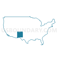
+%26+Bernalillo+County+(Southwest+Mesa+%26+South+Valley)+PUMA in New Mexico.png)
Albuquerque City (Southwest Mesa) & Bernalillo County (Southwest Mesa & South Valley) PUMA in New Mexico
Download
Graphs
Select a template below for downloading or customizing gragh for Albuquerque City (Southwest Mesa) & Bernalillo County (Southwest Mesa & South Valley) PUMA, New Mexico
+%26+Bernalillo+County+(Southwest+Mesa+%26+South+Valley)+PUMA%2c+New+Mexico_T0.png)
+%26+Bernalillo+County+(Southwest+Mesa+%26+South+Valley)+PUMA%2c+New+Mexico_T1.png)
+%26+Bernalillo+County+(Southwest+Mesa+%26+South+Valley)+PUMA%2c+New+Mexico_T2.png)
+%26+Bernalillo+County+(Southwest+Mesa+%26+South+Valley)+PUMA%2c+New+Mexico_T3.png)
+%26+Bernalillo+County+(Southwest+Mesa+%26+South+Valley)+PUMA%2c+New+Mexico_T4.png)
+%26+Bernalillo+County+(Southwest+Mesa+%26+South+Valley)+PUMA%2c+New+Mexico_T5.png)
+%26+Bernalillo+County+(Southwest+Mesa+%26+South+Valley)+PUMA%2c+New+Mexico_T6.png)
+%26+Bernalillo+County+(Southwest+Mesa+%26+South+Valley)+PUMA%2c+New+Mexico_T7.png)
+%26+Bernalillo+County+(Southwest+Mesa+%26+South+Valley)+PUMA%2c+New+Mexico.png)
Neighbors
Neighoring Public Use Microdata Area (by Name) Neighboring Public Use Microdata Area on the Map
- Albuquerque City (Central) & Bernalillo County (North Valley) PUMA, NM
- Albuquerque City (Northwest Mesa), Paradise Hills & Navajo Nation-Tohajiilee Chapter PUMA, NM
- Albuquerque City (Southeast Heights) PUMA, NM
- Valencia, Bernalillo (East Mountains) Counties & Isleta Pueblo PUMA, NM
Top 10 Neighboring County (by Population) Neighboring County on the Map
Top 10 Neighboring County Subdivision (by Population) Neighboring County Subdivision on the Map
- Albuquerque CCD, Bernalillo County, NM (633,223)
- West Bernalillo CCD, Bernalillo County, NM (7,796)
- Isleta Pueblo CCD, Bernalillo County, NM (2,489)
Top 10 Neighboring Place (by Population) Neighboring Place on the Map
Top 10 Neighboring Unified School District (by Population) Neighboring Unified School District on the Map
Top 10 Neighboring State Legislative District Lower Chamber (by Population) Neighboring State Legislative District Lower Chamber on the Map
- State House District 29, NM (59,097)
- State House District 13, NM (52,751)
- State House District 12, NM (38,723)
- State House District 16, NM (31,852)
- State House District 14, NM (28,078)
- State House District 10, NM (27,279)
- State House District 11, NM (26,265)
Top 10 Neighboring State Legislative District Upper Chamber (by Population) Neighboring State Legislative District Upper Chamber on the Map
- State Senate District 23, NM (84,821)
- State Senate District 11, NM (77,027)
- State Senate District 26, NM (52,067)
- State Senate District 13, NM (48,892)
- State Senate District 14, NM (42,652)
- State Senate District 12, NM (42,434)
Top 10 Neighboring 111th Congressional District (by Population) Neighboring 111th Congressional District on the Map
Top 10 Neighboring Census Tract (by Population) Neighboring Census Tract on the Map
- Census Tract 9406, Bernalillo County, NM (9,385)
- Census Tract 23, Bernalillo County, NM (8,842)
- Census Tract 24.02, Bernalillo County, NM (8,270)
- Census Tract 47.40, Bernalillo County, NM (7,313)
- Census Tract 47.34, Bernalillo County, NM (7,279)
- Census Tract 47.33, Bernalillo County, NM (7,218)
- Census Tract 47.41, Bernalillo County, NM (7,156)
- Census Tract 47.12, Bernalillo County, NM (7,147)
- Census Tract 47.13, Bernalillo County, NM (6,894)
- Census Tract 47.39, Bernalillo County, NM (6,745)