


Darke, Shelby & Preble Counties PUMA, Ohio
About
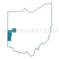
Outline

Summary
| Unique Area Identifier | 193753 |
| Name | Darke, Shelby & Preble Counties PUMA |
| State | Ohio |
| Area (square miles) | 1,436.91 |
| Land Area (square miles) | 1,429.90 |
| Water Area (square miles) | 7.02 |
| % of Land Area | 99.51 |
| % of Water Area | 0.49 |
| Latitude of the Internal Point | 40.07172270 |
| Longtitude of the Internal Point | -84.51770210 |
Maps

Graphs
Select a template below for downloading or customizing gragh for Darke, Shelby & Preble Counties PUMA, Ohio


Neighbors
Neighoring Public Use Microdata Area (by Name) Neighboring Public Use Microdata Area on the Map
- Auglaize, Mercer & Van Wert Counties PUMA, OH
- Butler County (North & West)--Middletown, Oxford & Trenton Cities PUMA, OH
- Henry, Randolph, Jay & Blackford Counties PUMA, IN
- Logan, Champaign & Hardin Counties PUMA, OH
- Miami County PUMA, OH
- Montgomery County (West)--Miamisburg & West Carrollton Cities PUMA, OH
- Wayne, Fayette, Rush & Union Counties PUMA, IN
Top 10 Neighboring County (by Population) Neighboring County on the Map
- Montgomery County, OH (535,153)
- Butler County, OH (368,130)
- Miami County, OH (102,506)
- Wayne County, IN (68,917)
- Darke County, OH (52,959)
- Shelby County, OH (49,423)
- Auglaize County, OH (45,949)
- Logan County, OH (45,858)
- Preble County, OH (42,270)
- Mercer County, OH (40,814)
Top 10 Neighboring County Subdivision (by Population) Neighboring County Subdivision on the Map
- Wayne township, Wayne County, IN (41,217)
- Oxford township, Butler County, OH (23,661)
- Clinton township, Shelby County, OH (21,221)
- Greenville township, Darke County, OH (17,613)
- St. Marys township, Auglaize County, OH (11,015)
- Union township, Miami County, OH (9,871)
- Clay township, Montgomery County, OH (8,847)
- Madison township, Butler County, OH (8,448)
- German township, Montgomery County, OH (8,429)
- Eaton city, Preble County, OH (8,407)
Top 10 Neighboring Place (by Population) Neighboring Place on the Map
- Richmond city, IN (36,812)
- Sidney city, OH (21,229)
- Greenville city, OH (13,227)
- Eaton city, OH (8,407)
- Union City city, IN (3,584)
- Lake Lakengren CDP, OH (3,383)
- Versailles village, OH (2,687)
- Arcanum village, OH (2,129)
- Camden village, OH (2,046)
- Bradford village, OH (1,842)
Top 10 Neighboring Unified School District (by Population) Neighboring Unified School District on the Map
- Richmond Community School Corporation, IN (42,104)
- Talawanda City School District, OH (35,511)
- Northmont City School District, OH (34,523)
- Sidney City School District, OH (25,726)
- Piqua City School District, OH (23,856)
- Greenville City School District, OH (22,536)
- Jay School Corporation, IN (21,253)
- Wapakoneta City School District, OH (19,151)
- Edgewood City School District, OH (18,746)
- Eaton Community City School District, OH (14,201)
Top 10 Neighboring State Legislative District Lower Chamber (by Population) Neighboring State Legislative District Lower Chamber on the Map
- State House District 78, OH (121,455)
- State House District 76, OH (120,854)
- State House District 79, OH (119,858)
- State House District 83, OH (119,433)
- State House District 77, OH (118,691)
- State House District 53, OH (118,174)
- State House District 36, OH (111,134)
- State House District 54, IN (63,197)
- State House District 55, IN (63,163)
- State House District 33, IN (58,513)
Top 10 Neighboring State Legislative District Upper Chamber (by Population) Neighboring State Legislative District Upper Chamber on the Map
- State Senate District 4, OH (368,130)
- State Senate District 1, OH (351,303)
- State Senate District 26, OH (347,609)
- State Senate District 12, OH (346,477)
- State Senate District 6, OH (336,772)
- State Senate District 5, OH (318,239)
- State Senate District 43, IN (129,512)
- State Senate District 27, IN (116,341)
Top 10 Neighboring 111th Congressional District (by Population) Neighboring 111th Congressional District on the Map
- Congressional District 6, IN (676,548)
- Congressional District 8, OH (663,644)
- Congressional District 3, OH (640,899)
- Congressional District 4, OH (632,771)
Top 10 Neighboring Census Tract (by Population) Neighboring Census Tract on the Map
- Census Tract 102, Champaign County, OH (7,260)
- Census Tract 5601, Darke County, OH (7,191)
- Census Tract 9679, Mercer County, OH (6,825)
- Census Tract 5550, Darke County, OH (6,486)
- Census Tract 1301.02, Montgomery County, OH (6,406)
- Census Tract 1501, Montgomery County, OH (6,335)
- Census Tract 11, Wayne County, IN (6,325)
- Census Tract 1401, Montgomery County, OH (5,999)
- Census Tract 3151, Miami County, OH (5,994)
- Census Tract 43, Logan County, OH (5,849)
Top 10 Neighboring 5-Digit ZIP Code Tabulation Area (by Population) Neighboring 5-Digit ZIP Code Tabulation Area on the Map
- 47374, IN (46,875)
- 45365, OH (30,561)
- 45056, OH (27,038)
- 45042, OH (26,451)
- 45356, OH (25,172)
- 45331, OH (22,930)
- 45895, OH (17,945)
- 45320, OH (15,691)
- 47371, IN (12,226)
- 45309, OH (12,123)