


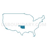
Oklahoma
About
Outline

Summary
| Unique Area Identifier | 201755 |
| Name | Oklahoma |
| Area (square miles) | 69,898.87 |
| Land Area (square miles) | 68,594.92 |
| Water Area (square miles) | 1,303.95 |
| % of Land Area | 98.13 |
| % of Water Area | 1.87 |
| Latitude of the Internal Point | 35.58941850 |
| Longtitude of the Internal Point | -97.48686830 |
| Total Population | 3,751,351 |
| Total Housing Units | 1,664,378 |
| Total Households | 1,460,450 |
| Median Age | 36.2 |
Maps
Graphs
Select a template below for downloading or customizing gragh for Oklahoma


Neighbors
Neighoring State and Equivalent (by Name) Neighboring State and Equivalent on the Map
County in Oklahoma (by Name) Neighboring County on the Map
- Adair County, OK
- Alfalfa County, OK
- Atoka County, OK
- Beaver County, OK
- Beckham County, OK
- Blaine County, OK
- Bryan County, OK
- Caddo County, OK
- Canadian County, OK
- Carter County, OK
- Cherokee County, OK
- Choctaw County, OK
- Cimarron County, OK
- Cleveland County, OK
- Coal County, OK
- Comanche County, OK
- Cotton County, OK
- Craig County, OK
- Creek County, OK
- Custer County, OK
- Delaware County, OK
- Dewey County, OK
- Ellis County, OK
- Garfield County, OK
- Garvin County, OK
- Grady County, OK
- Grant County, OK
- Greer County, OK
- Harmon County, OK
- Harper County, OK
- Haskell County, OK
- Hughes County, OK
- Jackson County, OK
- Jefferson County, OK
- Johnston County, OK
- Kay County, OK
- Kingfisher County, OK
- Kiowa County, OK
- Latimer County, OK
- Le Flore County, OK
- Lincoln County, OK
- Logan County, OK
- Love County, OK
- Major County, OK
- Marshall County, OK
- Mayes County, OK
- McClain County, OK
- McCurtain County, OK
- McIntosh County, OK
- Murray County, OK
- Muskogee County, OK
- Noble County, OK
- Nowata County, OK
- Okfuskee County, OK
- Oklahoma County, OK
- Okmulgee County, OK
- Osage County, OK
- Ottawa County, OK
- Pawnee County, OK
- Payne County, OK
- Pittsburg County, OK
- Pontotoc County, OK
- Pottawatomie County, OK
- Pushmataha County, OK
- Roger Mills County, OK
- Rogers County, OK
- Seminole County, OK
- Sequoyah County, OK
- Stephens County, OK
- Texas County, OK
- Tillman County, OK
- Tulsa County, OK
- Wagoner County, OK
- Washington County, OK
- Washita County, OK
- Woods County, OK
- Woodward County, OK
Top 10 County Subdivision in Oklahoma (by Population) Neighboring County Subdivision on the Map
- Tulsa CCD, Tulsa County, OK (569,469)
- Oklahoma City Southwest CCD, Oklahoma County, OK (429,392)
- Oklahoma City Southeast CCD, Oklahoma County, OK (145,193)
- Oklahoma City Northwest CCD, Oklahoma County, OK (127,076)
- North Cleveland CCD, Cleveland County, OK (121,027)
- Norman CCD, Cleveland County, OK (102,464)
- East Canadian CCD, Canadian County, OK (86,541)
- Lawton CCD, Comanche County, OK (72,351)
- Shawnee CCD, Pottawatomie County, OK (64,590)
- Stillwater CCD, Payne County, OK (63,113)
Top 10 Place in Oklahoma (by Population) Neighboring Place on the Map
- Oklahoma City city, OK (579,999)
- Tulsa city, OK (391,906)
- Norman city, OK (110,925)
- Broken Arrow city, OK (98,850)
- Lawton city, OK (96,867)
- Edmond city, OK (81,405)
- Moore city, OK (55,081)
- Midwest City city, OK (54,371)
- Enid city, OK (49,379)
- Stillwater city, OK (45,688)
Top 10 Elementary School District in Oklahoma (by Population) Neighboring Elementary School District on the Map
- Verdigris Public Schools, OK (5,503)
- Keys Public Schools, OK (4,534)
- Grand View Public School, OK (4,254)
- Lone Star Public School, OK (4,213)
- Grove Public School, OK (3,763)
- Justus-Tiawah Public School, OK (3,664)
- Keystone Public School, OK (3,400)
- Oakdale Public School, OK (3,200)
- North Rock Creek Public School, OK (3,079)
- Krebs Public School, OK (2,986)
Top 10 Unified School District in Oklahoma (by Population) Neighboring Unified School District on the Map
- Oklahoma City Public Schools, OK (285,940)
- Tulsa Public Schools, OK (284,811)
- Edmond Public Schools, OK (132,523)
- Moore Public Schools, OK (125,679)
- Putnam City Public Schools, OK (119,728)
- Norman Public Schools, OK (107,263)
- Broken Arrow Public Schools, OK (98,247)
- Lawton Public Schools, OK (92,621)
- Union Public Schools, OK (79,066)
- Midwest City-Del City Schools, OK (77,695)
Top 10 State Legislative District Lower Chamber in Oklahoma (by Population) Neighboring State Legislative District Lower Chamber on the Map
- State House District 74, OK (48,540)
- State House District 53, OK (48,374)
- State House District 39, OK (48,123)
- State House District 41, OK (46,325)
- State House District 82, OK (45,418)
- State House District 98, OK (44,506)
- State House District 43, OK (44,484)
- State House District 91, OK (44,349)
- State House District 46, OK (44,285)
- State House District 31, OK (44,222)
Top 10 State Legislative District Upper Chamber in Oklahoma (by Population) Neighboring State Legislative District Upper Chamber on the Map
- State Senate District 24, OK (98,936)
- State Senate District 22, OK (98,783)
- State Senate District 36, OK (94,207)
- State Senate District 47, OK (89,219)
- State Senate District 34, OK (88,558)
- State Senate District 41, OK (88,446)
- State Senate District 15, OK (87,049)
- State Senate District 37, OK (85,784)
- State Senate District 45, OK (85,350)
- State Senate District 25, OK (84,784)
Top 10 111th Congressional District in Oklahoma (by Population) Neighboring 111th Congressional District on the Map
- Congressional District 4, OK (785,424)
- Congressional District 1, OK (754,310)
- Congressional District 5, OK (749,336)
- Congressional District 3, OK (732,394)
- Congressional District 2, OK (729,887)
Top 10 Census Tract in Oklahoma (by Population) Neighboring Census Tract on the Map
- Census Tract 58.07, Tulsa County, OK (12,083)
- Census Tract 9.03, Grady County, OK (9,327)
- Census Tract 4001.02, McClain County, OK (9,323)
- Census Tract 8925, Carter County, OK (9,131)
- Census Tract 5010.01, Pottawatomie County, OK (8,391)
- Census Tract 6004, Logan County, OK (8,379)
- Census Tract 109, Payne County, OK (8,266)
- Census Tract 67.07, Tulsa County, OK (8,260)
- Census Tract 1082.13, Oklahoma County, OK (8,144)
- Census Tract 3008.01, Canadian County, OK (8,021)
Top 10 5-Digit ZIP Code Tabulation Area in Oklahoma (by Population) Neighboring 5-Digit ZIP Code Tabulation Area on the Map
- 74012, OK (57,526)
- 73099, OK (57,492)
- 73160, OK (53,666)
- 73505, OK (49,809)
- 73013, OK (43,933)
- 74133, OK (43,414)
- 73072, OK (42,797)
- 73034, OK (39,872)
- 74055, OK (38,680)
- 73071, OK (36,711)
Data
Demographic, Population, Households, and Housing Units
** Data sources from census 2010 **
Show Data on Map
Download Full List as CSV
Download Quick Sheet as CSV
| Subject | This Area | National |
|---|---|---|
| POPULATION | ||
| Total Population Map | 3,751,351 | 308,745,538 |
| POPULATION, HISPANIC OR LATINO ORIGIN | ||
| Not Hispanic or Latino Map | 3,419,344 | 258,267,944 |
| Hispanic or Latino Map | 332,007 | 50,477,594 |
| POPULATION, RACE | ||
| White alone Map | 2,706,845 | 223,553,265 |
| Black or African American alone Map | 277,644 | 38,929,319 |
| American Indian and Alaska Native alone Map | 321,687 | 2,932,248 |
| Asian alone Map | 65,076 | 14,674,252 |
| Native Hawaiian and Other Pacific Islander alone Map | 4,369 | 540,013 |
| Some Other Race alone Map | 154,409 | 19,107,368 |
| Two or More Races Map | 221,321 | 9,009,073 |
| POPULATION, SEX | ||
| Male Map | 1,856,977 | 151,781,326 |
| Female Map | 1,894,374 | 156,964,212 |
| POPULATION, AGE (18 YEARS) | ||
| 18 years and over Map | 2,821,685 | 234,564,071 |
| Under 18 years | 929,666 | 74,181,467 |
| POPULATION, AGE | ||
| Under 5 years | 264,126 | 20,201,362 |
| 5 to 9 years | 259,336 | 20,348,657 |
| 10 to 14 years | 253,664 | 20,677,194 |
| 15 to 17 years | 152,540 | 12,954,254 |
| 18 and 19 years | 111,944 | 9,086,089 |
| 20 years | 56,068 | 4,519,129 |
| 21 years | 54,032 | 4,354,294 |
| 22 to 24 years | 159,142 | 12,712,576 |
| 25 to 29 years | 265,737 | 21,101,849 |
| 30 to 34 years | 241,018 | 19,962,099 |
| 35 to 39 years | 232,742 | 20,179,642 |
| 40 to 44 years | 228,195 | 20,890,964 |
| 45 to 49 years | 261,242 | 22,708,591 |
| 50 to 54 years | 264,369 | 22,298,125 |
| 55 to 59 years | 235,969 | 19,664,805 |
| 60 and 61 years | 85,815 | 7,113,727 |
| 62 to 64 years | 118,698 | 9,704,197 |
| 65 and 66 years | 68,668 | 5,319,902 |
| 67 to 69 years | 90,724 | 7,115,361 |
| 70 to 74 years | 121,075 | 9,278,166 |
| 75 to 79 years | 95,051 | 7,317,795 |
| 80 to 84 years | 69,284 | 5,743,327 |
| 85 years and over | 61,912 | 5,493,433 |
| MEDIAN AGE BY SEX | ||
| Both sexes Map | 36.20 | 37.20 |
| Male Map | 34.90 | 35.80 |
| Female Map | 37.70 | 38.50 |
| HOUSEHOLDS | ||
| Total Households Map | 1,460,450 | 116,716,292 |
| HOUSEHOLDS, HOUSEHOLD TYPE | ||
| Family households: Map | 975,267 | 77,538,296 |
| Husband-wife family Map | 722,435 | 56,510,377 |
| Other family: Map | 252,832 | 21,027,919 |
| Male householder, no wife present Map | 73,524 | 5,777,570 |
| Female householder, no husband present Map | 179,308 | 15,250,349 |
| Nonfamily households: Map | 485,183 | 39,177,996 |
| Householder living alone Map | 401,153 | 31,204,909 |
| Householder not living alone Map | 84,030 | 7,973,087 |
| HOUSEHOLDS, HISPANIC OR LATINO ORIGIN OF HOUSEHOLDER | ||
| Not Hispanic or Latino householder: Map | 1,375,637 | 103,254,926 |
| Hispanic or Latino householder: Map | 84,813 | 13,461,366 |
| HOUSEHOLDS, RACE OF HOUSEHOLDER | ||
| Householder who is White alone | 1,126,295 | 89,754,352 |
| Householder who is Black or African American alone | 105,046 | 14,129,983 |
| Householder who is American Indian and Alaska Native alone | 104,630 | 939,707 |
| Householder who is Asian alone | 20,120 | 4,632,164 |
| Householder who is Native Hawaiian and Other Pacific Islander alone | 1,191 | 143,932 |
| Householder who is Some Other Race alone | 41,632 | 4,916,427 |
| Householder who is Two or More Races | 61,536 | 2,199,727 |
| HOUSEHOLDS, HOUSEHOLD TYPE BY HOUSEHOLD SIZE | ||
| Family households: Map | 975,267 | 77,538,296 |
| 2-person household Map | 434,417 | 31,882,616 |
| 3-person household Map | 219,620 | 17,765,829 |
| 4-person household Map | 178,628 | 15,214,075 |
| 5-person household Map | 87,900 | 7,411,997 |
| 6-person household Map | 34,017 | 3,026,278 |
| 7-or-more-person household Map | 20,685 | 2,237,501 |
| Nonfamily households: Map | 485,183 | 39,177,996 |
| 1-person household Map | 401,153 | 31,204,909 |
| 2-person household Map | 68,240 | 6,360,012 |
| 3-person household Map | 10,338 | 992,156 |
| 4-person household Map | 3,939 | 411,171 |
| 5-person household Map | 993 | 126,634 |
| 6-person household Map | 326 | 48,421 |
| 7-or-more-person household Map | 194 | 34,693 |
| HOUSING UNITS | ||
| Total Housing Units Map | 1,664,378 | 131,704,730 |
| HOUSING UNITS, OCCUPANCY STATUS | ||
| Occupied Map | 1,460,450 | 116,716,292 |
| Vacant Map | 203,928 | 14,988,438 |
| HOUSING UNITS, OCCUPIED, TENURE | ||
| Owned with a mortgage or a loan Map | 611,266 | 52,979,430 |
| Owned free and clear Map | 370,494 | 23,006,644 |
| Renter occupied Map | 478,690 | 40,730,218 |
| HOUSING UNITS, VACANT, VACANCY STATUS | ||
| For rent Map | 59,264 | 4,137,567 |
| Rented, not occupied Map | 2,717 | 206,825 |
| For sale only Map | 22,671 | 1,896,796 |
| Sold, not occupied Map | 8,405 | 421,032 |
| For seasonal, recreational, or occasional use Map | 35,187 | 4,649,298 |
| For migrant workers Map | 318 | 24,161 |
| Other vacant Map | 75,366 | 3,652,759 |
| HOUSING UNITS, OCCUPIED, AVERAGE HOUSEHOLD SIZE BY TENURE | ||
| Total: Map | 2.49 | 2.58 |
| Owner occupied Map | 2.54 | 2.65 |
| Renter occupied Map | 2.38 | 2.44 |
| HOUSING UNITS, OCCUPIED, TENURE BY RACE OF HOUSEHOLDER | ||
| Owner occupied: Map | 981,760 | 75,986,074 |
| Householder who is White alone Map | 802,001 | 63,446,275 |
| Householder who is Black or African American alone Map | 43,781 | 6,261,464 |
| Householder who is American Indian and Alaska Native alone Map | 67,547 | 509,588 |
| Householder who is Asian alone Map | 11,960 | 2,688,861 |
| Householder who is Native Hawaiian and Other Pacific Islander alone Map | 446 | 61,911 |
| Householder who is Some Other Race alone Map | 19,101 | 1,975,817 |
| Householder who is Two or More Races Map | 36,924 | 1,042,158 |
| Renter occupied: Map | 478,690 | 40,730,218 |
| Householder who is White alone Map | 324,294 | 26,308,077 |
| Householder who is Black or African American alone Map | 61,265 | 7,868,519 |
| Householder who is American Indian and Alaska Native alone Map | 37,083 | 430,119 |
| Householder who is Asian alone Map | 8,160 | 1,943,303 |
| Householder who is Native Hawaiian and Other Pacific Islander alone Map | 745 | 82,021 |
| Householder who is Some Other Race alone Map | 22,531 | 2,940,610 |
| Householder who is Two or More Races Map | 24,612 | 1,157,569 |
| HOUSING UNITS, OCCUPIED, TENURE BY HISPANIC OR LATINO ORIGIN OF HOUSEHOLDER | ||
| Owner occupied: Map | 981,760 | 75,986,074 |
| Not Hispanic or Latino householder Map | 940,332 | 69,617,625 |
| Hispanic or Latino householder Map | 41,428 | 6,368,449 |
| Renter occupied: Map | 478,690 | 40,730,218 |
| Not Hispanic or Latino householder Map | 435,305 | 33,637,301 |
| Hispanic or Latino householder Map | 43,385 | 7,092,917 |
| HOUSING UNITS, OCCUPIED, TENURE BY HOUSEHOLD SIZE | ||
| Owner occupied: Map | 981,760 | 75,986,074 |
| 1-person household Map | 222,740 | 16,453,569 |
| 2-person household Map | 379,461 | 27,618,605 |
| 3-person household Map | 156,161 | 12,517,563 |
| 4-person household Map | 127,864 | 10,998,793 |
| 5-person household Map | 59,965 | 5,057,765 |
| 6-person household Map | 22,494 | 1,965,796 |
| 7-or-more-person household Map | 13,075 | 1,373,983 |
| Renter occupied: Map | 478,690 | 40,730,218 |
| 1-person household Map | 178,413 | 14,751,340 |
| 2-person household Map | 123,196 | 10,624,023 |
| 3-person household Map | 73,797 | 6,240,422 |
| 4-person household Map | 54,703 | 4,626,453 |
| 5-person household Map | 28,928 | 2,480,866 |
| 6-person household Map | 11,849 | 1,108,903 |
| 7-or-more-person household Map | 7,804 | 898,211 |
Loading...