


04-1 First Presbyterian Church Voting District, Williamson County, Tennessee
About
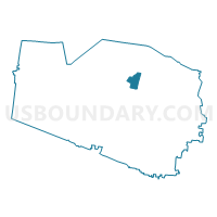
Outline

Summary
| Unique Area Identifier | 669989 |
| Name | 04-1 First Presbyterian Church Voting District |
| County | Williamson County |
| State | Tennessee |
| Area (square miles) | 3.84 |
| Land Area (square miles) | 3.84 |
| Water Area (square miles) | 0.00 |
| % of Land Area | 100.00 |
| % of Water Area | 0.00 |
| Latitude of the Internal Point | 35.94703230 |
| Longtitude of the Internal Point | -86.82760640 |
Maps


Graphs
Select a template below for downloading or customizing gragh for 04-1 First Presbyterian Church Voting District, Williamson County, Tennessee


Neighbors
Neighoring Voting District (by Name) Neighboring Voting District on the Map
- 04-4 Franklin Christian Church Voting District, Williamson County, TN
- 04-5 Prairie Life Fitness Center Voting District, Williamson County, TN
- 06-1 Concord Church of Christ Voting District, Williamson County, TN
- 07-2 Baptist Children's Home Voting District, Williamson County, TN
- 07-3 Clearview Baptist Church Voting District, Williamson County, TN
- 08-1 Grassland Middle School Voting District, Williamson County, TN
- 10-2 Liberty Elementary Voting District, Williamson County, TN
- 12-2 People's Church Voting District, Williamson County, TN
Top 10 Neighboring County Subdivision (by Population) Neighboring County Subdivision on the Map
- District 4, Williamson County, TN (19,318)
- District 6, Williamson County, TN (13,435)
- District 8, Williamson County, TN (12,947)
- District 10, Williamson County, TN (12,197)
- District 7, Williamson County, TN (11,976)
- District 12, Williamson County, TN (10,803)
Top 10 Neighboring Place (by Population) Neighboring Place on the Map
Top 10 Neighboring Elementary School District (by Population) Neighboring Elementary School District on the Map
Top 10 Neighboring Secondary School District (by Population) Neighboring Secondary School District on the Map
Top 10 Neighboring Unified School District (by Population) Neighboring Unified School District on the Map
Top 10 Neighboring State Legislative District Lower Chamber (by Population) Neighboring State Legislative District Lower Chamber on the Map
Top 10 Neighboring State Legislative District Upper Chamber (by Population) Neighboring State Legislative District Upper Chamber on the Map
Top 10 Neighboring 111th Congressional District (by Population) Neighboring 111th Congressional District on the Map
Top 10 Neighboring Census Tract (by Population) Neighboring Census Tract on the Map
- Census Tract 502.08, Williamson County, TN (6,192)
- Census Tract 510.01, Williamson County, TN (5,785)
- Census Tract 509.05, Williamson County, TN (5,697)
- Census Tract 504.06, Williamson County, TN (5,152)
- Census Tract 509.04, Williamson County, TN (4,954)
- Census Tract 507.02, Williamson County, TN (4,004)
- Census Tract 502.05, Williamson County, TN (3,344)
- Census Tract 503.07, Williamson County, TN (3,065)
- Census Tract 503.06, Williamson County, TN (1,657)