


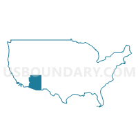
Coconino County--Flagstaff City PUMA, Arizona
About
Outline

Summary
| Unique Area Identifier | 192164 |
| Name | Coconino County--Flagstaff City PUMA |
| State | Arizona |
| Area (square miles) | 18,661.34 |
| Land Area (square miles) | 18,618.88 |
| Water Area (square miles) | 42.46 |
| % of Land Area | 99.77 |
| % of Water Area | 0.23 |
| Latitude of the Internal Point | 35.82969190 |
| Longtitude of the Internal Point | -111.77372770 |
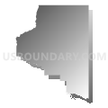
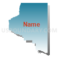
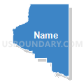
Maps

Graphs
Select a template below for downloading or customizing gragh for Coconino County--Flagstaff City PUMA, Arizona


Neighbors
Neighoring Public Use Microdata Area (by Name) Neighboring Public Use Microdata Area on the Map
- Gila, Graham, Greenlee & Pinal (East) Counties PUMA, AZ
- Mohave & La Paz Counties--Lake Havasu City PUMA, AZ
- Navajo & Apache Counties PUMA, AZ
- Southeast Utah & Uintah Basin Region PUMA, UT
- Southwest & South Central Utah (Outside Washington County)--Cedar City PUMA, UT
- Yavapai County PUMA, AZ
Top 10 Neighboring County (by Population) Neighboring County on the Map
- Yavapai County, AZ (211,033)
- Mohave County, AZ (200,186)
- Coconino County, AZ (134,421)
- Navajo County, AZ (107,449)
- Gila County, AZ (53,597)
- San Juan County, UT (14,746)
- Kane County, UT (7,125)
Top 10 Neighboring County Subdivision (by Population) Neighboring County Subdivision on the Map
- Prescott CCD, Yavapai County, AZ (119,809)
- Flagstaff CCD, Coconino County, AZ (89,754)
- Kingman CCD, Mohave County, AZ (66,268)
- Snowflake CCD, Navajo County, AZ (46,905)
- Camp Verde-Sedona CCD, Yavapai County, AZ (36,611)
- Mingus Mountain CCD, Yavapai County, AZ (36,091)
- Tuba City CCD, Coconino County, AZ (31,639)
- Payson CCD, Gila County, AZ (23,807)
- Winslow-Holbrook CCD, Navajo County, AZ (18,068)
- Fort Apache CCD, Navajo County, AZ (11,176)
Top 10 Neighboring Place (by Population) Neighboring Place on the Map
- Flagstaff city, AZ (65,870)
- Sedona city, AZ (10,031)
- Winslow city, AZ (9,655)
- Tuba City CDP, AZ (8,611)
- Page city, AZ (7,247)
- Doney Park CDP, AZ (5,395)
- Kanab city, UT (4,312)
- Williams city, AZ (3,023)
- Kachina Village CDP, AZ (2,622)
- Grand Canyon Village CDP, AZ (2,004)
Top 10 Neighboring Elementary School District (by Population) Neighboring Elementary School District on the Map
- Cottonwood-Oak Creek Elementary District, AZ (29,429)
- Beaver Creek Elementary District, AZ (4,808)
- Pine Strawberry Elementary District, AZ (2,952)
- Maine Consolidated School District, AZ (1,279)
- Young Elementary School District, AZ (885)
- Chevelon Butte School District, AZ (650)
Top 10 Neighboring Secondary School District (by Population) Neighboring Secondary School District on the Map
Top 10 Neighboring Unified School District (by Population) Neighboring Unified School District on the Map
- Flagstaff Unified District, AZ (91,658)
- School District Not Defined, AZ (69,809)
- Payson Unified District, AZ (21,636)
- Chino Valley Unified District, AZ (21,594)
- Tuba City Unified District, AZ (16,064)
- San Juan School District, UT (14,746)
- Sedona-Oak Creek Joint Unified District, AZ (14,440)
- Page Unified District, AZ (13,046)
- Winslow Unified District, AZ (11,556)
- Camp Verde Unified District, AZ (11,452)
Top 10 Neighboring State Legislative District Lower Chamber (by Population) Neighboring State Legislative District Lower Chamber on the Map
- State House District 4, AZ (294,239)
- State House District 1, AZ (217,022)
- State House District 3, AZ (216,687)
- State House District 5, AZ (192,258)
- State House District 2, AZ (177,904)
- State House District 73, UT (34,070)
- State House District 69, UT (31,813)
Top 10 Neighboring State Legislative District Upper Chamber (by Population) Neighboring State Legislative District Upper Chamber on the Map
- State Senate District 4, AZ (294,239)
- State Senate District 1, AZ (217,022)
- State Senate District 3, AZ (216,687)
- State Senate District 5, AZ (192,258)
- State Senate District 2, AZ (177,904)
- State Senate District 28, UT (94,905)
- State Senate District 27, UT (93,972)
Top 10 Neighboring 111th Congressional District (by Population) Neighboring 111th Congressional District on the Map
- Congressional District 2, AZ (972,839)
- Congressional District 2, UT (890,993)
- Congressional District 1, AZ (774,310)
Top 10 Neighboring Census Tract (by Population) Neighboring Census Tract on the Map
- Census Tract 19, Yavapai County, AZ (14,010)
- Census Tract 9501, Mohave County, AZ (10,851)
- Census Tract 10, Coconino County, AZ (8,156)
- Census Tract 2.02, Yavapai County, AZ (8,054)
- Census Tract 21, Coconino County, AZ (7,247)
- Census Tract 3, Coconino County, AZ (7,175)
- Census Tract 9, Coconino County, AZ (6,905)
- Census Tract 23, Coconino County, AZ (6,674)
- Census Tract 11.02, Coconino County, AZ (6,650)
- Census Tract 22, Coconino County, AZ (6,457)
Top 10 Neighboring 5-Digit ZIP Code Tabulation Area (by Population) Neighboring 5-Digit ZIP Code Tabulation Area on the Map
- 86001, AZ (40,776)
- 86004, AZ (37,338)
- 85541, AZ (21,877)
- 86047, AZ (14,970)
- 86322, AZ (11,480)
- 86045, AZ (11,354)
- 86336, AZ (11,320)
- 86040, AZ (10,283)
- 86011, AZ (6,362)
- 86351, AZ (6,349)