


Schenectady County--Schenectady City PUMA, New York
About
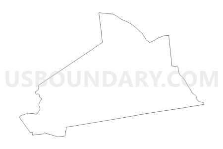
Outline

Summary
| Unique Area Identifier | 193587 |
| Name | Schenectady County--Schenectady City PUMA |
| State | New York |
| Area (square miles) | 209.39 |
| Land Area (square miles) | 204.52 |
| Water Area (square miles) | 4.87 |
| % of Land Area | 97.67 |
| % of Water Area | 2.33 |
| Latitude of the Internal Point | 42.81754210 |
| Longtitude of the Internal Point | -74.04358340 |
Maps


Graphs
Select a template below for downloading or customizing gragh for Schenectady County--Schenectady City PUMA, New York


Neighbors
Neighoring Public Use Microdata Area (by Name) Neighboring Public Use Microdata Area on the Map
- Albany County (Outside Albany City) PUMA, NY
- Fulton & Montgomery Counties PUMA, NY
- Otsego, Schoharie, Oneida (South) & Herkimer (South) Counties PUMA, NY
- Saratoga County (Outer) PUMA, NY
- Saratoga County (South & Central) PUMA, NY
Top 10 Neighboring County (by Population) Neighboring County on the Map
- Albany County, NY (304,204)
- Saratoga County, NY (219,607)
- Schenectady County, NY (154,727)
- Montgomery County, NY (50,219)
- Schoharie County, NY (32,749)
Top 10 Neighboring County Subdivision (by Population) Neighboring County Subdivision on the Map
- Colonie town, Albany County, NY (81,591)
- Schenectady city, Schenectady County, NY (66,135)
- Clifton Park town, Saratoga County, NY (36,705)
- Guilderland town, Albany County, NY (35,303)
- Glenville town, Schenectady County, NY (29,480)
- Rotterdam town, Schenectady County, NY (29,094)
- Niskayuna town, Schenectady County, NY (21,781)
- Ballston town, Saratoga County, NY (9,776)
- Duanesburg town, Schenectady County, NY (6,122)
- Amsterdam town, Montgomery County, NY (5,566)
Top 10 Neighboring Place (by Population) Neighboring Place on the Map
- Schenectady city, NY (66,135)
- Rotterdam CDP, NY (20,652)
- Scotia village, NY (7,729)
- East Glenville CDP, NY (6,616)
- Niskayuna CDP, NY (4,859)
- Mariaville Lake CDP, NY (722)
- Duanesburg CDP, NY (391)
- Delanson village, NY (377)
- Esperance village, NY (345)
- Duane Lake CDP, NY (323)
Top 10 Neighboring Unified School District (by Population) Neighboring Unified School District on the Map
- Schenectady City School District, NY (66,116)
- Shenendehowa Central School District, NY (62,406)
- North Colonie Central School District, NY (39,534)
- South Colonie Central School District, NY (39,307)
- Guilderland Central School District, NY (36,131)
- Amsterdam City School District, NY (25,711)
- Niskayuna Central School District, NY (23,182)
- Rotterdam-Mohonasen Central School District, NY (20,336)
- Burnt Hills-Ballston Lake Central School District, NY (18,789)
- Scotia-Glenville Central School District, NY (18,677)
Top 10 Neighboring State Legislative District Lower Chamber (by Population) Neighboring State Legislative District Lower Chamber on the Map
- Assembly District 109, NY (139,831)
- Assembly District 110, NY (138,331)
- Assembly District 105, NY (137,005)
- Assembly District 104, NY (132,644)
- Assembly District 127, NY (129,764)
Top 10 Neighboring State Legislative District Upper Chamber (by Population) Neighboring State Legislative District Upper Chamber on the Map
- State Senate District 43, NY (322,103)
- State Senate District 44, NY (317,410)
- State Senate District 46, NY (304,204)
- State Senate District 51, NY (296,420)
Top 10 Neighboring 111th Congressional District (by Population) Neighboring 111th Congressional District on the Map
Top 10 Neighboring Census Tract (by Population) Neighboring Census Tract on the Map
- Census Tract 146.07, Albany County, NY (8,262)
- Census Tract 319, Schenectady County, NY (7,442)
- Census Tract 138.01, Albany County, NY (7,278)
- Census Tract 218, Schenectady County, NY (6,779)
- Census Tract 324.04, Schenectady County, NY (6,737)
- Census Tract 626.02, Saratoga County, NY (6,725)
- Census Tract 135.08, Albany County, NY (6,547)
- Census Tract 320, Schenectady County, NY (6,447)
- Census Tract 331.02, Schenectady County, NY (6,122)
- Census Tract 321.01, Schenectady County, NY (5,703)
Top 10 Neighboring 5-Digit ZIP Code Tabulation Area (by Population) Neighboring 5-Digit ZIP Code Tabulation Area on the Map
- 12303, NY (29,857)
- 12309, NY (29,343)
- 12010, NY (28,937)
- 12302, NY (27,582)
- 12306, NY (25,636)
- 12110, NY (21,908)
- 12304, NY (21,482)
- 12308, NY (15,335)
- 12019, NY (14,740)
- 12307, NY (7,692)