


SEA 43-1377 Voting District, King County, Washington
About
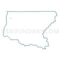
Outline

Summary
| Unique Area Identifier | 685758 |
| Name | SEA 43-1377 Voting District |
| County | King County |
| State | Washington |
| Area (square miles) | 0.09 |
| Land Area (square miles) | 0.06 |
| Water Area (square miles) | 0.03 |
| % of Land Area | 61.76 |
| % of Water Area | 38.24 |
| Latitude of the Internal Point | 47.65216630 |
| Longtitude of the Internal Point | -122.32839190 |
Maps


Graphs
Select a template below for downloading or customizing gragh for SEA 43-1377 Voting District, King County, Washington


Neighbors
Neighoring Voting District (by Name) Neighboring Voting District on the Map
- SEA 43-1376 Voting District, King County, WA
- SEA 43-1378 Voting District, King County, WA
- SEA 43-1379 Voting District, King County, WA
- SEA 43-1982 Voting District, King County, WA
- SEA 43-2023 Voting District, King County, WA
- SEA 43-2105 Voting District, King County, WA
Top 10 Neighboring County Subdivision (by Population) Neighboring County Subdivision on the Map
Top 10 Neighboring Place (by Population) Neighboring Place on the Map
Top 10 Neighboring Unified School District (by Population) Neighboring Unified School District on the Map
Top 10 Neighboring State Legislative District Lower Chamber (by Population) Neighboring State Legislative District Lower Chamber on the Map
Top 10 Neighboring State Legislative District Upper Chamber (by Population) Neighboring State Legislative District Upper Chamber on the Map
Top 10 Neighboring 111th Congressional District (by Population) Neighboring 111th Congressional District on the Map
Top 10 Neighboring Census Tract (by Population) Neighboring Census Tract on the Map
- Census Tract 52, King County, WA (6,076)
- Census Tract 54, King County, WA (4,948)
- Census Tract 61, King County, WA (4,796)
- Census Tract 51, King County, WA (3,662)