


04 Englewood School Voting District, McMinn County, Tennessee
About
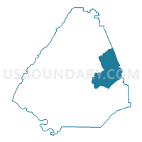
Outline

Summary
| Unique Area Identifier | 669118 |
| Name | 04 Englewood School Voting District |
| County | McMinn County |
| State | Tennessee |
| Area (square miles) | 32.71 |
| Land Area (square miles) | 32.71 |
| Water Area (square miles) | 0.00 |
| % of Land Area | 100.00 |
| % of Water Area | 0.00 |
| Latitude of the Internal Point | 35.44546580 |
| Longtitude of the Internal Point | -84.48923310 |
Maps


Graphs
Select a template below for downloading or customizing gragh for 04 Englewood School Voting District, McMinn County, Tennessee


Neighbors
Neighoring Voting District (by Name) Neighboring Voting District on the Map
- 01 Sweetwater High School Voting District, Monroe County, TN
- 02 Etowah Community Center Voting District, McMinn County, TN
- 03 Central High School Voting District, McMinn County, TN
- 06 Madisonville Middle School Voting District, Monroe County, TN
- 08 Niota School Voting District, McMinn County, TN
- 11 McMinn Courthouse Voting District, McMinn County, TN
Top 10 Neighboring County Subdivision (by Population) Neighboring County Subdivision on the Map
- District 2, Monroe County, TN (16,598)
- District 1, Monroe County, TN (14,479)
- District 2, McMinn County, TN (11,398)
- District 4, McMinn County, TN (10,404)
- District 3, McMinn County, TN (9,759)
Top 10 Neighboring Place (by Population) Neighboring Place on the Map
Top 10 Neighboring Elementary School District (by Population) Neighboring Elementary School District on the Map
Top 10 Neighboring Secondary School District (by Population) Neighboring Secondary School District on the Map
Top 10 Neighboring Unified School District (by Population) Neighboring Unified School District on the Map
Top 10 Neighboring State Legislative District Lower Chamber (by Population) Neighboring State Legislative District Lower Chamber on the Map
Top 10 Neighboring State Legislative District Upper Chamber (by Population) Neighboring State Legislative District Upper Chamber on the Map
Top 10 Neighboring 111th Congressional District (by Population) Neighboring 111th Congressional District on the Map
Top 10 Neighboring Census Tract (by Population) Neighboring Census Tract on the Map
- Census Tract 9251, Monroe County, TN (8,292)
- Census Tract 9706, McMinn County, TN (7,196)
- Census Tract 9253, Monroe County, TN (7,155)
- Census Tract 9701.02, McMinn County, TN (4,655)
- Census Tract 9705, McMinn County, TN (3,865)
- Census Tract 9704.01, McMinn County, TN (3,617)
Top 10 Neighboring 5-Digit ZIP Code Tabulation Area (by Population) Neighboring 5-Digit ZIP Code Tabulation Area on the Map
- 37303, TN (25,461)
- 37354, TN (16,483)
- 37874, TN (14,979)
- 37331, TN (7,656)
- 37329, TN (5,588)
- 37826, TN (4,361)