


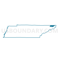
04 Avoca School Voting District, Sullivan County, Tennessee
About
Outline

Summary
| Unique Area Identifier | 669788 |
| Name | 04 Avoca School Voting District |
| County | Sullivan County |
| State | Tennessee |
| Area (square miles) | 13.50 |
| Land Area (square miles) | 13.50 |
| Water Area (square miles) | 0.00 |
| % of Land Area | 99.98 |
| % of Water Area | 0.02 |
| Latitude of the Internal Point | 36.53842350 |
| Longtitude of the Internal Point | -82.21984850 |
Maps


Graphs
Select a template below for downloading or customizing gragh for 04 Avoca School Voting District, Sullivan County, Tennessee


Neighbors
Neighoring Voting District (by Name) Neighboring Voting District on the Map
- 02VP Valley Pike School Voting District, Sullivan County, TN
- 05 Sullivan Co Offices Voting District, Sullivan County, TN
- 08 Buffalo Ruritan Bldg Voting District, Sullivan County, TN
- 17W Anderson School Voting District, Sullivan County, TN
- 17Y YMCA Of Bristol Voting District, Sullivan County, TN
- 21 East High School Voting District, Sullivan County, TN
Top 10 Neighboring County Subdivision (by Population) Neighboring County Subdivision on the Map
- District 2, Sullivan County, TN (19,899)
- District 4, Sullivan County, TN (18,932)
- District 1, Sullivan County, TN (6,876)
- District 3, Sullivan County, TN (6,198)
Top 10 Neighboring Place (by Population) Neighboring Place on the Map
Top 10 Neighboring Unified School District (by Population) Neighboring Unified School District on the Map
Top 10 Neighboring State Legislative District Lower Chamber (by Population) Neighboring State Legislative District Lower Chamber on the Map
Top 10 Neighboring State Legislative District Upper Chamber (by Population) Neighboring State Legislative District Upper Chamber on the Map
Top 10 Neighboring 111th Congressional District (by Population) Neighboring 111th Congressional District on the Map
Top 10 Neighboring Census Tract (by Population) Neighboring Census Tract on the Map
- Census Tract 434.01, Sullivan County, TN (5,142)
- Census Tract 427.01, Sullivan County, TN (4,948)
- Census Tract 430, Sullivan County, TN (4,692)
- Census Tract 434.02, Sullivan County, TN (4,668)
- Census Tract 426, Sullivan County, TN (4,112)
- Census Tract 432.01, Sullivan County, TN (4,102)
- Census Tract 425, Sullivan County, TN (3,529)
- Census Tract 427.02, Sullivan County, TN (2,103)